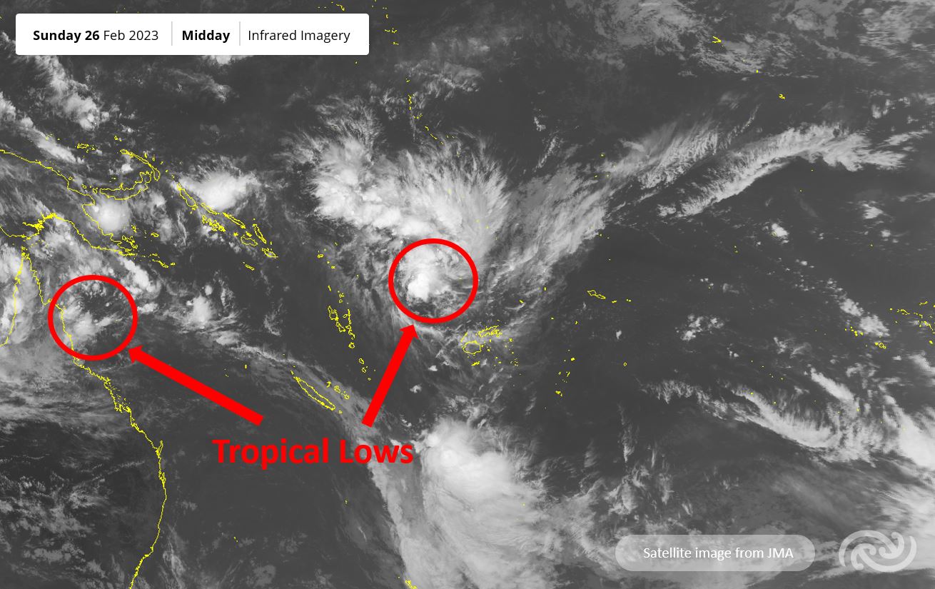
Metservice has advised that a tropical low 08F was analysed north of Fiji on February 26 and was moving west towards Vanuatu until February 28 with the risk of it becoming a tropical cyclone expecting to be high.
“The system is expected to recurve south and remain close to Vanuatu during Tuesday [February 28] and Wednesday [March 1], and is likely to reach severe tropical cyclone category,” Metservice said.
“Another tropical low over the Coral Sea is expected to move east, and the chance for it developing into a tropical cyclone is expected to become low on Wednesday [March 1], moderate on Thursday [March 2] and high in the outlook period.
“This system is expected to follow a similar track to tropical low 08F, and move across or close to Vanuatu late next week.”
Metservice said while the risk of the tropical cyclone directly impacting New Zealand after it left the tropics was relatively low, rain and large swells for eastern areas were more likely.
Meanwhile, a Heavy Rain Watch is in place for the Coromandel Peninsula with periods of heavy rain, downpours and possible thunderstorms until 4pm on Monday, February 27.
Metservice has also advised that a trough over the Central North Island will weaken on February 28.
“There is moderate confidence [a 40 per cent likelihood] of warning amounts of rain for the Coromandel Peninsula,” Metservice said.


